A device for determining the altitude and angular positions of an aircraft using radio range finders, patented by developers from South Ural State University, is an inexpensive and easy-to-implement invention that allows an aircraft (rocket carrier and UAV) to land on the ground. The work is being carried out within the framework of the Priority 2030 program under the Youth and Children national project.
A unique navigation device allows determining the altitude and angular position of an aircraft relative to the earth's surface, thereby helping to ensure its automated landing without human intervention. The parameters of the object in the air read by the device will help to correctly control its engine so that the device maintains a compensated vertical position right before landing.
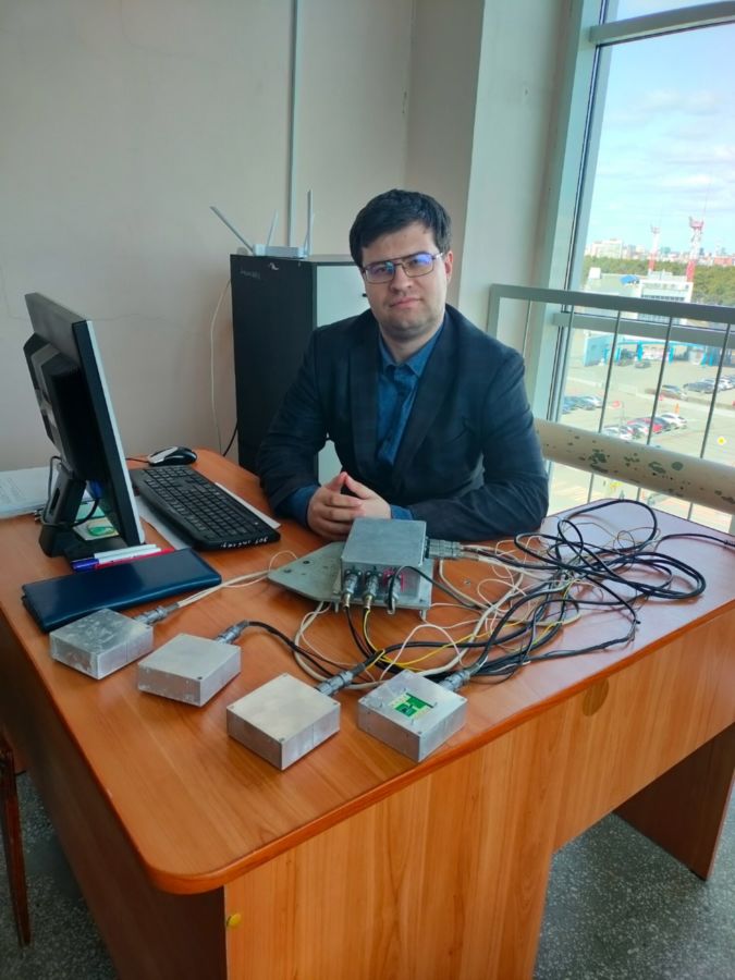
"Unlike classic onboard radio navigation systems, such as radio rangefinders that determine the distance from an aircraft to a target, the system we have created allows to determine the angular position of an aircraft relative to the earth's surface," explained Nikolai Dudarev, Associate Professor at the SUSU Department of Radio Electronics and Communication Systems. "A new approach to using radio rangefinders becomes available thanks to a developed algorithm for converting the ranges obtained from four radio rangefinders included in the system, into the angular positions of an aircraft."
Having established the parameters of the spatial position of an object, the new device promptly transmits the measured and processed navigation information to the aircraft control system.
As a rule, all coordinates and angular position of an object going to land are determined not by one system, but by a whole complex of them with a combination of various algorithms. The SUSU developers combined the functions of several measuring devices (radio rangefinder, gyroscope, etc.) in one simple and inexpensive device, making it extremely effective.
The device is a lightweight aluminium box with a receiving and transmitting path (with antennas inside, a lower opening for the emitter and a processing system), which is attached to the body of an aircraft.
The invention is unique because for the first time the device is based on several radio rangefinders that simultaneously determine several values of an object's distance from the earth's surface and automatically solve the geometric problem in the presence of angular deviations of the device, issuing already processed data so that specialists can promptly and correctly compensate for the spatial position of the device for a safe landing.
Among the advantages, experts highlight not only the efficiency of the device, but its low cost as well. Compared to an analogue ground-based radar system, the device by the Chelyabinsk developers will cost ten times less.
"A mock-up of the device was developed to test its functionality. We used a Chinese transceiver module, which costs about three thousand roubles per one piece," said Aleksandr Kolenchuk, engineer at the SUSU Aircraft Control Systems Research Laboratory. "The total cost of the device, taking into account the purchase of components and the manufacture of design elements, was low compared to navigation devices that perform similar functions. We managed to save money by using an unusual approach: we used a radio rangefinder to solve a problem that no one had solved before: we used it to determine angular positions using our original algorithm."
In 2024 the new navigation device successfully passed experimental testing during field tests of the engine demonstrator for a reusable launch vehicle, which is being developed by SUSU scientists under a state assignment. Today, the invention is ready for implementation by the university's industrial partners.